|
|
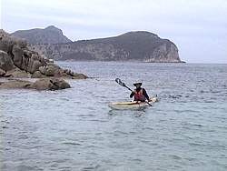
Once again we would have to start before dawn to catch the right
tides for the 47 km crossing to Erith Island. We were going to use
the 50/50 rule again, that is, time our crossing so that we had half
the journey on an outgoing tide followed by half on an incoming tide.
We wanted to be well east of Erith Island as we arrived. We were going
to paddle on a compass bearing.
|
|
|
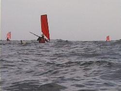
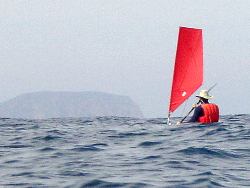
The NSW guys had set off about an hour before we did but we gradually
caught up and passed them about half way through the journey. Our
larger sails were obviously an advantage.
|
|
|
A slight breeze had developed during the morning and it was just
enough to give us assistance. By watching the coast of Erith we could
tell that we were now being taken westward by incoming tide. At one
stage Matt said that according to the GPS we were doing 11km/hr, but
only 7km/hr towards Erith Island. The tides are certainly something
to be reckoned with in Bass Strait.
|
|
|
Although we were paddling a compass bearing initially, Jamie and
I in the double, decided to investigate what we thought were some
other paddlers as we approached Erith Island. This was a mistake as
we then had to paddle hard against the incoming tide to get into Murray
Passage. Phil had also followed us so he found it even harder in the
single kayak.
|
|
|
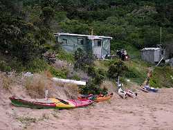
We
stayed close to the shore of Erith Island as we entered Murray Passage
before swinging round into West Bay. This was the most convenient and
sheltered campsite in the Kent group of islands. We could see back across
to Deal Island, there was a hut with a water supply and a sheltered
beach for swimming.
|
|
|
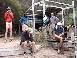
It wasn't too long before the four NSW guys turned up and we compared
notes on out paddle. The NSW women had decided not to paddle today
because of the predicted change. They were a little nervous after
being caught in rough weather back at Wilson's Promontory. It had
taken us about 6 hours to paddle from Hogan Island in near perfect
conditions.
|
|
|
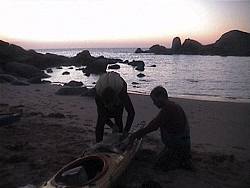
We had set up our tents in some sheltered clearings under the trees
some distance from the hut. We thought the hut might have been infested
with rats like the one on Hogan Island but the NSW guys didn't have
any problems.
|
|
|
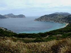
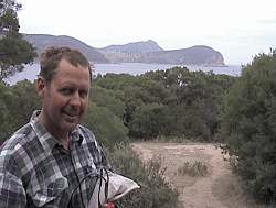
After a leisurely lunch we explored the hill above the hut. From the
top we had a panoramic view over Murray Passage to Deal Island and the
lighthouse. Off to the south was Dover island. Some people went on to
explore the large aboriginal cave in the cliff on the northern end of
the island.
|
|
|
From
the top of the hill we found that our cdma mobile phones worked, so
we took the opportunity to ring friends and family and confirn our location
and that everything was going to plan. We also discussed our strategy
for dealing with the tides and how it was important not to get side
tracked from the compass bearing. We also noted that the group had split
up somewhat in the last few kilometres of the journey.
|