|
|
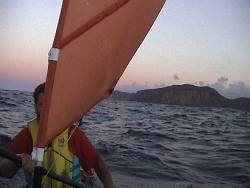
A 4.30am start saw us paddling
down Murray Passage in the dark. We agreed to skirt around the southern
end of Deal Island before following our compass bearing to Killiecrankie
67km away. We planned to be well out to the east with an outgoing tide
before being brought back by the flooding tide at the end of the journey.
There was a light breeze blowing giving us a bit of assistance.
|
|
|
In the dark the group
got split up but as daylight appeared we regrouped. Its amazing how
close you can be but still not see anyone in the dark. I had switched
on my flashing light but unfortunately no one else had thought to keep
a light handy. We weren't expecting to have to paddle for long in the
dark. They had known exactly where we were but we had no way of seeing
them.
|
|
|
This little episode triggered
some discussion and we agreed from then on to paddle Matt's compass
bearing ( for some reason we all kept to the same compass bearing but
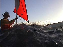
were actually diverging) and stop on the hour to keep together. The
sea conditions were quite moderate though currents against wind produced
some sloppy seas.
|
|
|
We passed Wrights Rock
well to the west of where we wnated to be and realized that the flooding
tide was either stronger than expected or it had started earlier than
anticipated. Fortunately a favourable wind from the SW allowed us to
recover some lost ground . As we passed Craggy Island the current was
quite powerful and we understood how a previous group had missed Killiecrankie
altogether and ended up around Cape Frankland on Royden Island.
|
|
|
About half way between
Craggy Is and Killicrankie I thought back to an earlier crossing by
the Matsuyker Club when at this point the group had been out in a 45+knt
gale for 11 hours. Laurie Ford yelled to the group " I don't think
we are going to make it", meaning get into Killicrankie because
of the tide. Toby Clarke understood this to mean they were doomed and
set off hell bent to get to Kiilicrankie. They didn't meet up again
until the next day when the rest of the group paddled into Killiecrankie.
|
|
|
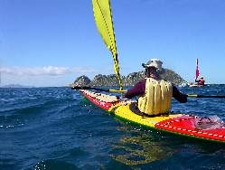
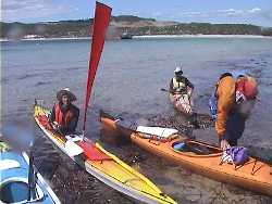
We cruised into the bay
with all sails up. There was distinct feeling of achievement at this
point. For some of us this was home territory as we had visited this
part of Flinders Island a number of times. From now on we knew what
was infront of us. Visit the Flinders
Island Trip web site to see details of those trips.
|
|
|
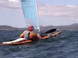
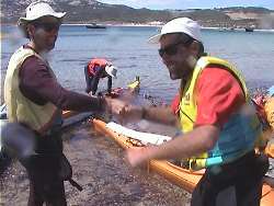
The relief showed on everyone's
face as we congratulated each other on thecompletion of this 67km leg
in a little over 71/2 hours. We hadn't seen any of the other paddlers
who had set off from Winter Cove at about the same time as we left Erith
Island.
|
|
|
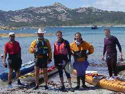
About 3/4's of an hour after
we landed a solitary NSW paddler rounded the corner from the west and
pulled up on the beach alongside us. We casually asked where the others
were, expecting him to say, just around the corner. However to our amazement
he said " I don't know". When asking when had he seen them last
he said about 5.00am that morning!!
|
|
A little later out in
the bay to the east we saw a couple of sails. The others recounted later
how at that stage they were discussing who was going to ring up and
tell Rod's wife they had lost him in Bass Strait! Apparently in the
dark that morning Rod had left his paddling gloves behind and gone back
to get them while the others waited. In the ensuing mix up they had
separated and kept paddling thinking they would catch up with the the
rest of the group. They did catch up, at Killiecrankie.
|