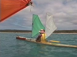
 | On Thursday, 11th January, Laurie and I sailed along the southern shore of Three Hummock Island to the Allistons homestead where we had arranged to refill our water bottles. At this time of the year few if any of the creeks are running. |
 | In the afternoon we crossed Hope Channel, a short but potentially rough crossing because of strong tidal currents. Today it was no problem. From the cliffs overlooking Shepherds on Hunter Island we could look back at the hummock we had climbed the night before. |
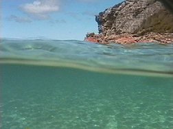 | The clear waters of Shepherds Bay were inviting and we went for a swim. At that moment a pod of dolphins entered the bay on their way south. Neither of us had our cameras ready. We watched the behaviour of two Pacific Gulls circling anxiously over their chick. |
 | The campsite at Shepherds Bay is probably the best in this area. Tucked in behind the coastal wattles and ti tree, it is largely unknown. This also means it offers shelter from any conceivable weather. |
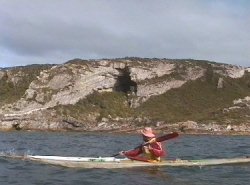
 | Friday morning dawned once again with sunny skies, this was the fifth in a row. Our destination on the 1994 trip was Cave Bay. In 1996 we went out to Penguin Island instead. The morning was warm and calm as we were helped down the coast by tidal currrents. |
 | The huge sea cave was once occupied by Tasmanian Aborigines. At that time the sea level was considerably higher due to an inter galcial period. Mick and I landed nearby on the 1994 trip. |
 | It is quite difficult to access the cave, particularly at high tide. We chose to climb to the cliff top and then descend a rather steep drop to a ledge running to the cave entrance. |
 | The cave has been the site of archeological studies. It was thought to have been occupied about 40 000 years ago. Remains of fires and shellfish to a considerable depth indicated that the cave was inhabited for thousands of years. |
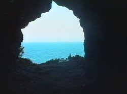 | From the interior of the cave we looked out, due east. This was were we were heading next, Walker Island, about 15 km away. The only problem was a sand bank that lay directly in our path. We set a compass bearing course to avoid stranding on it. |
