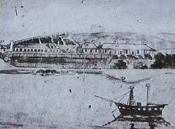
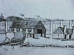
 | This sketch of Sarah Island, made in the 1820's
shows what the island looked like from the side where we landed. The fences shown were over eight feet tall and built to protect the convict settlement from the incessant westerlies. The officers houses are on the right. |
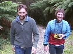 | Mick Verrier, Grant Hyland and I walked round the island. Laurie had decided to head off and wait for us at the next campsite on the Braddon River. Since our last visit the rangers had put interpretive signs and photo's around the island. |
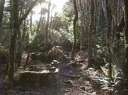
 | This was the old three story penitentiary. The Tasmanian Aborigines who were imprisoned here were put in the bottom cells. They were frequently urinated upon by convicts in the higher cells. |
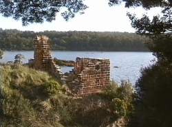
 | This ruin was part of the old bakery. The settlement was supposed to be self contained but because of the terrible weather convicts and soldiers were often forced to accept rations while supplies were sent around the southern coast from Hobart. Some escaped convicts even turned to cannibalism to survive. |
 | One of the main occupations of the convicts was timber getting and boat building. 1000 year old Huon Pine trees were cut down, manhandled to the island and used in building boats for the colony of Van Diemans Land as it was then known. Some convicts seized a boat and escaped to S. America were they were recaptured and hanged. |
 | It was getting late as we left Sarah Island and the ghostly tales of murder and cruelty. Sarah Island was considered to be the end of the earth in the 1820's. We headed across to the eastern shore of the harbour and our campsite at the Braddon river. |
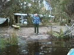 | An hours sailing later we were met by Laurie Ford. This weekend shack was tucked away in the bush on the banks of the Braddon river. We decided that it would be convenient to use the shack. |
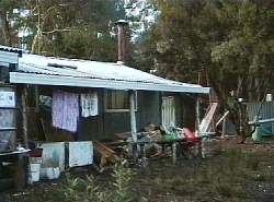 | Laurie had got a roaring fire going inside and with a few candles that we always take with us we could enjoy a home away from home. |
